10.25.23
- Published to https://clobberx.github.io
10.25.23
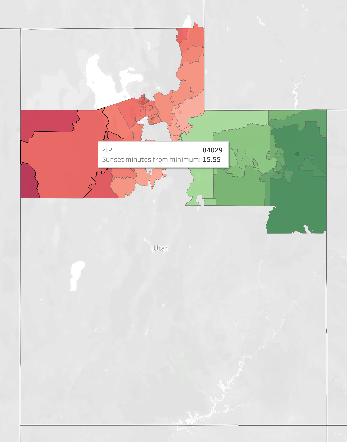
- Full CONUS maps drafted and sent to state senator
10.22.23
- Revisit free options, need the following data points:
- City, State, Zip, Latitude, Longitude, Time Zone
- Free files from gazetteer do not contain time zone information
- Ordered ZIPList5 Geocode data from zipinfo.com
- Tableau license obtained
10.15.23
- Sample data mapped in Tableau. Email sent to Senator Johnson.
10.8.23
- Started 14 day Tableau trial, downloaded desktop app
- How to
- Sample data from Utah: Minimum sunset 20:48:55, Maximum 21:08:12, Roughly 19 minutes across state
- Formatting in cells from NOAA: H:MM:SS;@

9.25.23
- Still need a way to capture time zone from either zip code or lat/lon
- Cloned repo: git@github.com:eggert/tz.git - may not be entirely helpful
- Python app that takes lat/lon input: https://github.com/jannikmi/timezonefinder/blob/master/docs/0_getting_started.rst
9.24.23
- No progress on Sunshine Protection Act per sleepfoundation.org
- IANA.org may have the data I need for free
- Found a similar global project on blog.poormansmat.net
- erichurst@github has created files of lat/long/zip code before from US Census Gazeteer Files. Contains county data from US Census!!!
- plotly looks promising for python base visualization
9.11.23
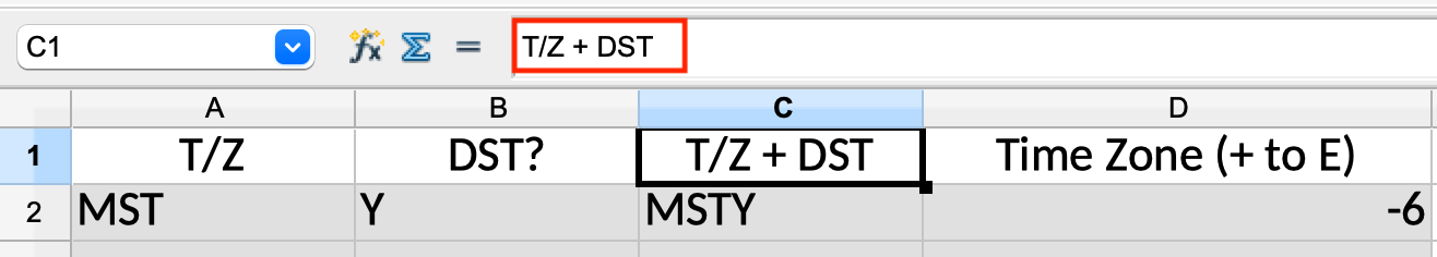
VLOOKUP created for Named Range to convert T/Z & DST? to concatenated string and numeric representation
- VLOOKUP in OpenOffice
- OpenOffice uses
semicolon spacebetween arguments in a function v a singlecommain MS Excel
- OpenOffice uses
- Using named ranges in OpenOffice
- Named Ranges can be
insertedfrom the menu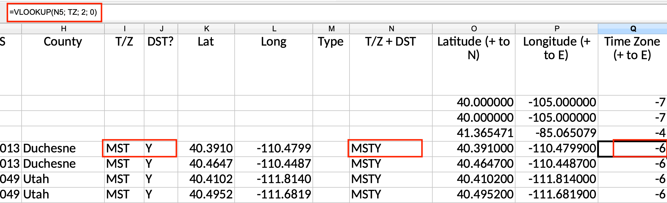
- Named Ranges can be
9.9.23
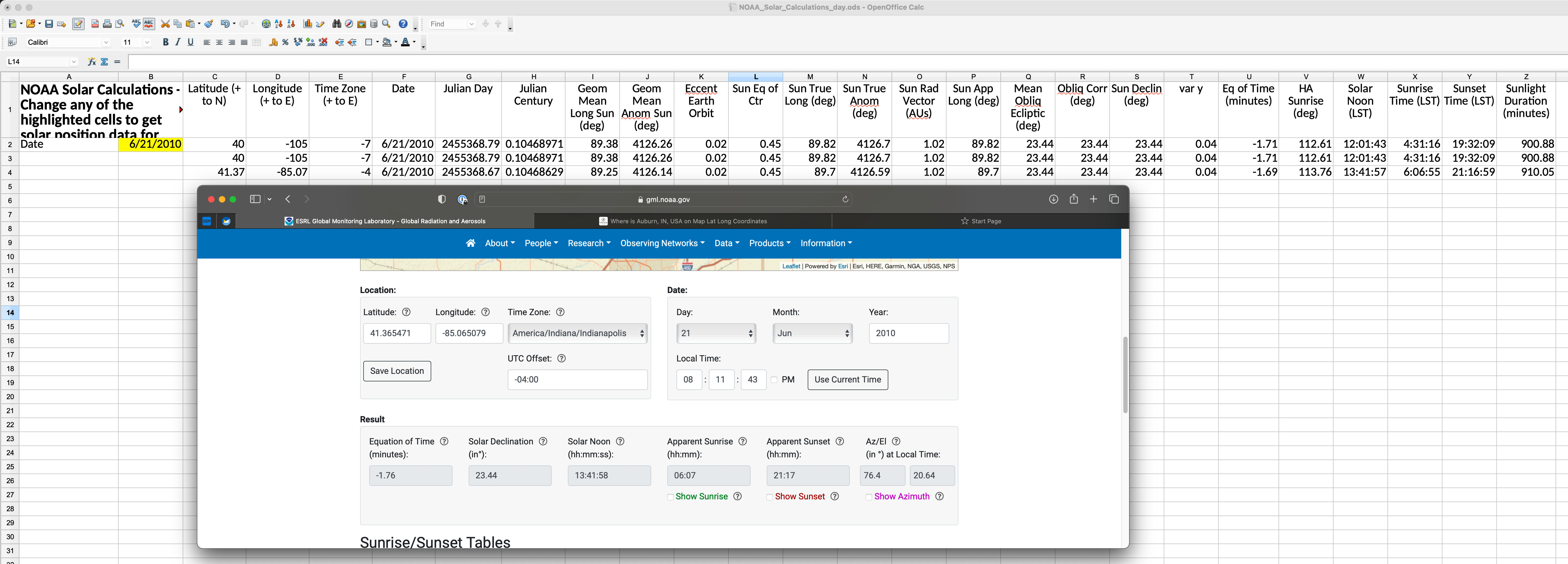
NOAA Solar Calculations Workbook Modified:
- Moved Lat, Lon, TZ to rows
- Removed columns that are not direct dependencies of Sunrise & Sunset Time
- Confirmed correct calculation for local lat, lon, tz
- Moved workbook to repo
- Changed paste location in IDE
- Downloaded sample data from zipinfo.com
9.9.23
First look at NOAA Solar Calculations workbook.
9.7.23
Log entries to keep track of project timeline.
Initial Tech Stack: VSCodium, Github pages running Jekyll with Just the Docs template, OpenOffice. May want to use web.archive.org (aka “WaybackMachine”) to ensure any research is available in the future when a page is changed or taken down.
NOAA published some spreadsheets that calculate sunset times. Plan to review and see if formulae will work for large number of locations
Tech